
Find the Current Taylor County Owner of Record
The Assessor’s search is the first stop for the owner name on a Taylor County parcel. Select Taylor County. Then search by owner, street, district, map, parcel, subparcel, property class, tax class, or land use. Four modes are available. Basic, Appraisal-Sales, Advanced, and Prior Ownership each slice the data differently. Record the tax year and the full district-map-parcel-suffix sequence. That sequence lets you check the same parcel in the county’s other systems.
What the search returns is the owner of record carried on an assessment roll. It identifies the current parcel account well. But it can lag a recently recorded instrument, and it is not a title certificate. Not every co-owner or private beneficial interest will be visible. Open the selected parcel itself rather than trusting the search-list snippet alone.
The owner field answers one question. Which name is attached to the assessed parcel for that roll cycle? It does not reveal every person with an interest. It does not explain how the name got there. The Assessor search is not a live deed feed either. Use the County Clerk’s index to locate the recorded deed. Then compare its date with the year on the assessment entry. Use the West Virginia Assessment portal to select Taylor County. Review the current parcel search fields there.
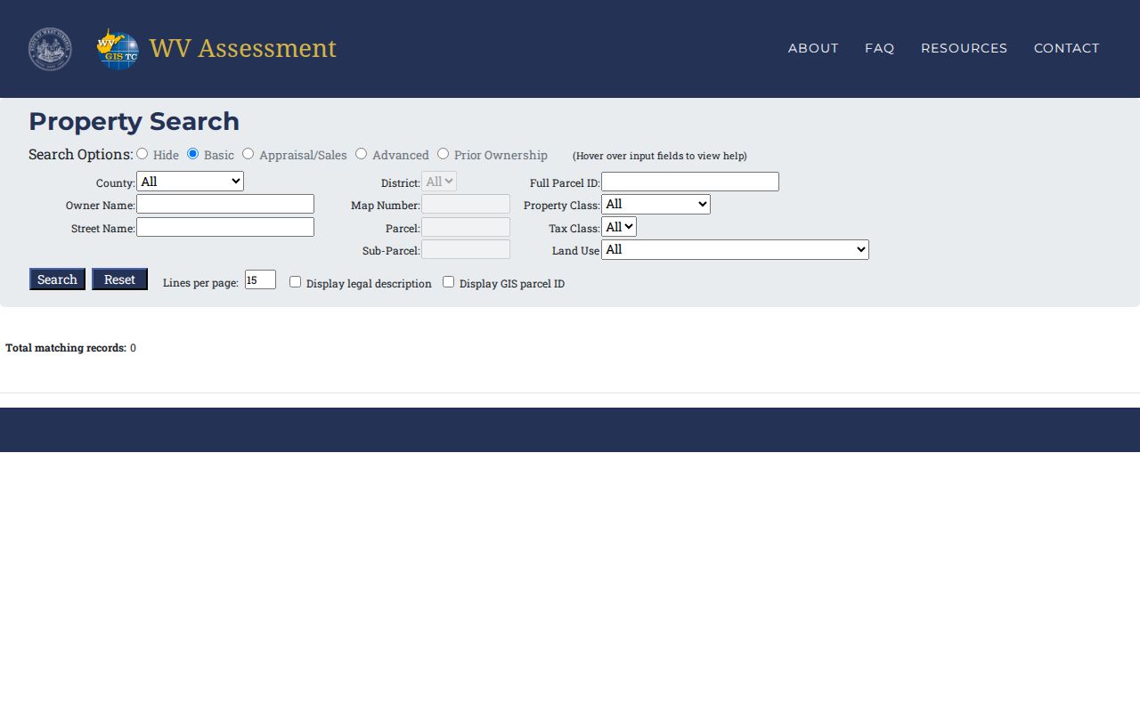
The official search page for Taylor County parcels shows a lookup screen rather than a single owner result. Once you pick a parcel, compare it against the recorded deed to confirm the owner of record.
Check the Latest Taylor County Deed
Once the assessment result points to a likely owner, look for the most recent conveyance in the County Clerk’s compiled index. Search the name as grantee to find an acquisition. Search it again as grantor to catch a later sale or transfer. Document type, subindex, book, party role, and the legal description all help confirm that an index result concerns the same parcel. An owner-name match alone can point to another tract or to someone with a similar name.
The Clerk’s index covers more than deeds. Liens, releases, wills, and miscellaneous filings appear there too. Read the underlying deed to identify the parties, the recording reference, the parcel description, and the nature of the interest conveyed. A tax-roll owner label and a deed each carry their own date and purpose. Compare their timing before deciding the two conflict.
For the latest transfer, run the current owner name as grantee and check later entries under the same party as grantor. Note any special role. If the instrument names a trustee, executor, officer, or special commissioner, preserve that role in your notes. The document may convey an interest on behalf of another party, so the signer’s name should never be substituted for the deed’s stated grantee.
Ask the Taylor County Assessor About a Current Entry
The Assessor’s office sits at 214 W. Main Street, Room 107, Grafton, WV 26354. Listed hours are Monday through Friday, 8:30 a.m. to 4:30 p.m. Call 304-265-2420 or fax 304-265-8010. Give staff the parcel number, tax year, and physical address, and ask which owner name appears on the current roll or how to correct an assessment record. Check the West Virginia assessor directory listing for Taylor County before contacting the office.
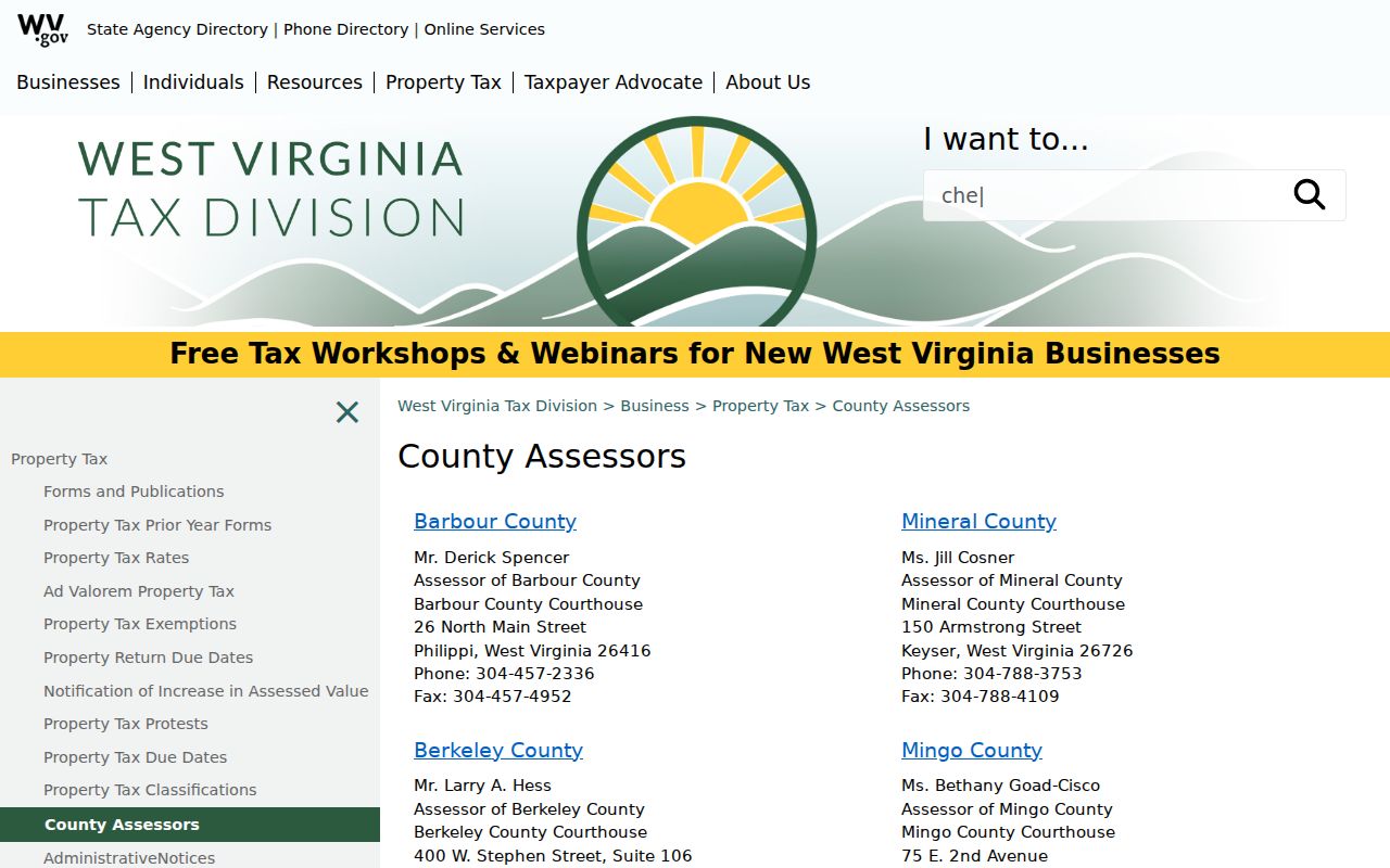
The directory page lays out the office route. Ask the Assessor directly about a specific roll entry and its effective year. On the call, confirm whether the owner name shown is the current tax-roll label and whether a deed has been reflected in that assessment cycle. Ask also which record reference to use for a written correction request. For record-specific interpretation, the office itself is the source to rely on.
Current Owner and the Annual Assessment Cycle
West Virginia's assessment calendar turns on a July 1 valuation date. The Assessor sets assessed value at 60 percent of market value. That annual snapshot explains a common lag. A deed recorded after the cycle's effective point may lag. It may not refresh a current property search result right away. Keep the assessment year beside the owner of record name. Call the Assessor when the transfer is recent. Or call when the online record shows an earlier owner.
This cycle explains timing only. It does not mean a transfer failed to record. Verify the instrument in the Clerk index. Ask the Assessor whether a tax roll update is pending. Or ask whether a different parcel number is involved.
For a recent transaction, compare three dates. The deed signing date and the recording date can differ. The assessment year in the portal can differ too. The visible assessment owner is simply the name on the roll for its cycle. The Clerk's recorded deed records supply the filing reference for the transfer itself.
Suppose a record still lists the former owner. Give the Assessor the parcel number and deed citation. Ask whether the roll reflects the transfer. Or ask whether the instrument covers a different parcel or partial interest. A web result alone cannot tell which cause applies.
Separate the Owner’s Mailing Address from the Site
A parcel's physical address marks where the land or building sits. The owner mailing address is simply where tax or assessment mail may go. The two can sit in different places. A Grafton or Flemington postal label does not prove the parcel lies inside that municipality. Nor does a mailing address identify every property one person owns.
Match the parcel map by physical location. Use the mailing field only for mail. The labels may look reversed. Contact the Assessor with the parcel ID rather than assuming the record belongs to a second property.
The state parcel viewer keeps these fields separate too. Its popup owner may not list every deed party. Treat the map as a way to identify the property, not a complete ownership statement. Check the Assessor roll and the deed for the relevant year.
Co-Owners and Entity Names on a Current Record
The state parcel viewer can show a single owner even when the deed names co-owners. An assessment label may instead carry a trust, estate, corporation, or limited-liability entity. No individual names may appear at all. Search the full entity name in the Clerk index. Then review the deed's signature and party sections. This shows who conveyed or received the interest.
Public property records never show private beneficial ownership. A short map label is not a full account of legal interests.
The viewer's owner label can be shorter than the deed's full party block. Compare the parcel ID, physical location, and recorded description first. Only then decide the names refer to the same property. Keep the mailing address separate. It may point to a correspondence destination rather than the assessed site.
Resolve a Taylor County Owner-Name Difference
Name discrepancies often trace to initials, punctuation, a recent deed, a trust role, or a parcel mismatch. Compare the document date, book/page, legal description, district, map, parcel, and suffix. When a current owner label will not reconcile, ask the Assessor which parcel account it belongs to, and ask the Clerk for the full recorded instrument. The two offices may not update on one schedule. The Taylor County portal pages offer no combined owner-status report.
Each office answers its own question. The Assessor explains roll fields and effective years. The Clerk identifies the recorded instrument and its copy path. Give each the reference it controls. The Assessor wants the tax year and parcel ID. The Clerk wants party names, recording date, and book/page.
Limits of a Current Owner Lookup
An assessment result shows the name the tax roll links to the parcel for that cycle. A deed documents an instrument filed with the Clerk. Neither a search snippet nor a map popup is a title opinion or a survey. Neither guarantees that no later or unrecorded interest exists. For a transaction or legal dispute, request the official deed and consult a title professional or attorney.
Routing helps here. The Assessor handles tax value and classification questions. The County Clerk handles copies of conveyances. A licensed surveyor settles exact boundaries.
The County Clerk's document inquiry page links to the public compiled index. The Assessor's site offers assessment and map-card routes. Note which portal and search mode you used if an owner field will not resolve. Then ask the office that maintains the missing detail, because no single screen settles every ownership question.