
Finding Taylor County Property Records by Address
No single Taylor County screen returns every land record. Start at the West Virginia Property Assessment portal and pick Taylor County for any assessed parcel. The search fields are generous, covering owner name, street, district, map, parcel, subparcel, tax class, property class, and land use. If you already have the parcel number, enter the whole district-map-parcel-suffix sequence intact. Leading zeroes matter. The statewide parcel viewer is a separate map tool. It can start from an E911 address, but a map hit and an assessment hit are not the same thing.
Once the Assessor portal shows a match, record the parcel ID, owner label, physical address, district, and map and parcel numbers before you move on. Then take a party name to the County Clerk's compiled index. That index locates deeds and other recorded instruments. The clerk side is organized around parties. The assessor side runs on property and tax-roll fields. A name match in one system is only a lead to inspect, not proof that both records describe the same person or parcel.
- Select Taylor County in the statewide assessment portal and try the exact street or owner name.
- Open a likely parcel and write down the full parcel identifier and legal description.
- Use the parcel viewer to compare the location and neighboring geometry.
- Search the Clerk’s index under the grantor and grantee names for the recorded transfer.
- Check the tax year and contact the custodian if a bill, image, or certified copy is needed.
What a Taylor County Property Result Shows
The assessment search offers filters, not a guarantee that every field appears for every parcel. Four options frame different questions. Choose among Basic, Appraisal-Sales, Advanced, and Prior Ownership. A result may surface the owner label, physical address, tax district, map and parcel, class, or valuation details. Open the individual parcel view to see what that record actually holds.
Treat this list as a starting point. A blank field never proves that no sale or co-owner exists. Some details must be checked in the record itself.
| Search controls | County, district, owner name, street, map, parcel, subparcel, property class, tax class, and land use |
|---|---|
| Parcel key | District, map, parcel, and suffix; preserve leading zeroes when entering a number |
| Assessment modes | Basic, Appraisal-Sales, Advanced, and Prior Ownership |
| Deed index | Document type, subindex, book, party name, and grantor/grantee or creditor/debtor role |
| Not established by a search hit | Clear title, a surveyed boundary, a complete list of beneficial owners, or current tax payment status |
The state assessment page shows the county selector and its search categories before any parcel is opened. Use those controls to narrow the field. Compare parcel keys, not street labels. Open the West Virginia Property Assessment portal to see Taylor County's search fields.
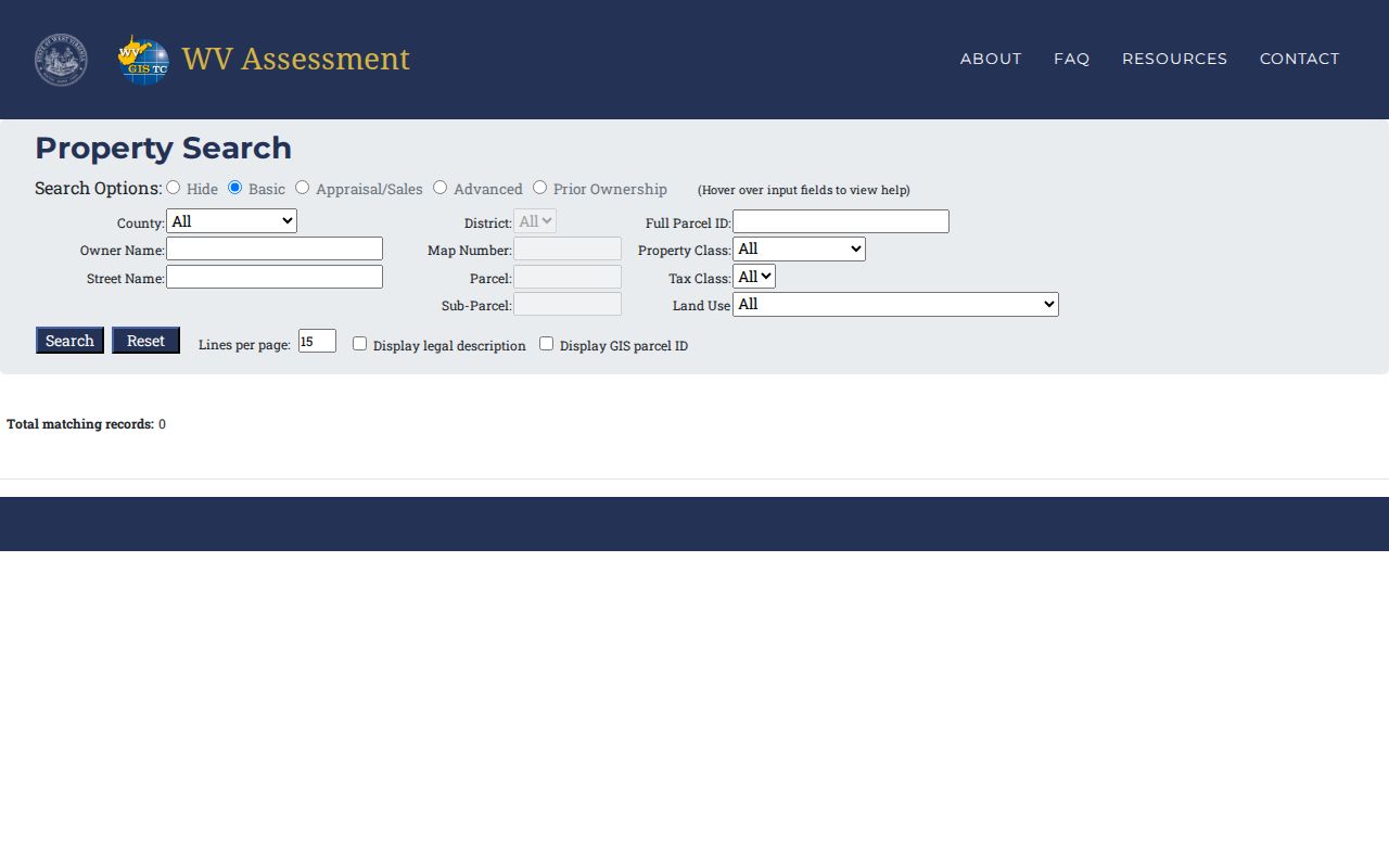
The screen documents the available filters rather than a sample parcel result. Check a result's exact fields after selecting a property.
Choose an Address, Owner, or Parcel Search
Pick your first key by what evidence you hold. An address works when you know the building or location. A name suits tracing one party across several properties. The full parcel identifier is best when you need to match an existing record exactly. Each key has a weakness. Street addresses get formatted differently across systems, party names carry spelling variants, and a parcel number breaks if its suffix or leading zero is dropped.
| Search key | Best first use | Record path | Check before relying |
|---|---|---|---|
| Street or E911 address | Locate a visible property | Assessment portal, then state parcel viewer | Road names and mailing addresses can differ |
| Owner or party name | Follow a person or entity through records | Assessor owner field and Clerk party index | Variant spellings, entity names, and similar names |
| District, map, parcel, suffix | Match the same parcel across records | Assessment, GIS, map cards, and deed references | Keep the sequence and leading zeroes intact |
A map view can show where a result sits. But never settle a boundary by outline alone. For the recorded transfer, move to the County Clerk index and inspect the actual deed. The deed may cite acreage, a district, adjoining land, or a prior book and page rather than a modern street number. Older instruments often skip the street number entirely.
Taylor County’s Clerk Index Uses Party Roles
Taylor County's compiled Clerk index opens a public search route to deeds and many other recorded instruments. Controls cover document type, subindex, book, party role, and party name. A conveyance search is straightforward once you know the roles. Search the seller as grantor. Search the buyer as grantee. Liens and releases work differently, using creditor and debtor roles. Run the query both directions whenever a transfer is unclear from another record's names.
Remember what the index is. Each hit yields a book and page citation or an electronic record entry, a pointer rather than the legal instrument itself. Open the image. Or ask the Clerk's office to pull the recorded document. No earliest year for online coverage is published. For the wider deed route, see Taylor County deed records.
Broad queries mislead. A wide name search returns liens, wills, and miscellaneous entries alongside deeds. Narrow by instrument category first. Then check each party's role. A creditor or debtor hit marks a financing or lien record rather than a transfer, while a will or miscellaneous entry may explain a later conveyance signed by a representative.
Copy the citation first. Call if the online result hides the full image. The County Clerk sits at 128 W. Main Street, Annex 2, in Grafton. Weekday hours run 8:30 a.m. to 4:30 p.m. Ask whether a page image, certified copy, or paper-book lookup is available.
Keep the Taylor County Parcel Identifier Intact
A Taylor County parcel key is built from a district, map, parcel, and suffix. Those pieces separate nearby tracts and their assessment records. Copy the number whole. Lose the district or the ending suffix and you may land on the wrong record. Drop a leading zero and even a correct number can fail to match. Older deeds often give a legal description instead. Bridge into the modern parcel system with that description plus the Clerk's book and page reference.
Keep the parcel identifier next to the property's address, owner label, and tax year. Mailing addresses can belong to an owner elsewhere. A map popup may not show every co-owner either. When a deed and the current assessment disagree, look for a later conveyance or a parcel division before calling it an error.
Street searches reward patience. Try the road name if a full address fails. Confirm with the parcel key from the resulting record. For a party search, compare the exact owner name against the grantor and grantee results. Do not guess from a nearby name. Every step should end with a stable parcel identifier or recording citation that anyone could use to reopen the same record.
Use the State Parcel Viewer as a Cross-Check
West Virginia's parcel viewer works well as a cross-check on Taylor County tracts. It locates parcels by E-911 address. It displays parcel attributes, geometry, coordinates, and buffers around a chosen area. Select the parcel before trusting any detail. Popups can show just one owner. The mailing address may differ from the site address. Boundaries draw at roughly 1:18,056 scale, making the viewer a locator and research aid rather than a survey.
Compare district and map/parcel/suffix with the Assessor. If the map seems to hold several tracts, or its shape clashes with a deed description, ask the Assessor which map card or record applies. Never infer legal acreage or boundaries from a screen line. Open the West Virginia parcel viewer to compare the parcel location and attributes.
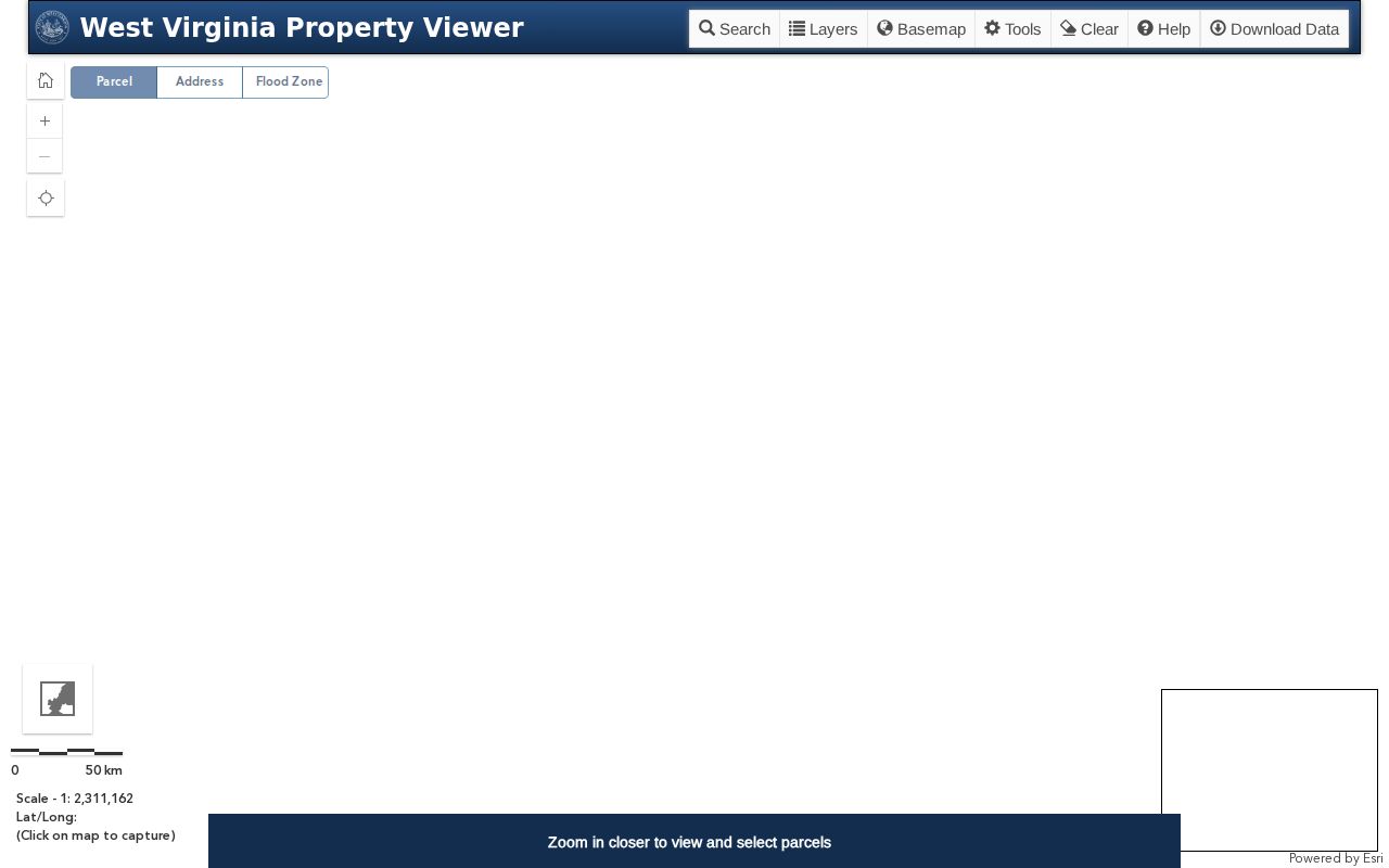
The state viewer shows parcel-search and map tools. The parcel record itself still must be opened and checked against the Clerk's deed.
When a Taylor County Online Search Comes Up Empty
An empty result is rarely a dead end. Often the search key differs from the record. The document may predate the online index. In the Clerk index, document type and party role can change what appears. Try a variant spelling first. Then run a prior owner, or swap the street address for the parcel number. In the assessment portal, select Taylor County and confirm the district before touching other fields.
Older title work needs different tools. The West Virginia Archives finding aid catalogs Taylor County deed books from 1844 through 1901, plus an index running from 1844 through 1970. Not every image is online, though. The Clerk can explain copies and current access. Archives staff can point a reader to the historic index or microfilm described in the finding aid.
Confirm the right county and district first. A valid parcel key may go in as one sequence or split into separate map and parcel fields, depending on the search mode. If the first try used a street name, run the owner or the full parcel number instead. A person search deserves care. Compare the location before accepting a match. A careful note recording the exact terms, mode, and date lets a second visit retrace the same path.
Indexed party roles help when names disagree. The assessment owner field may not match the name a seller supplies or an old map card shows. Search both grantor and grantee positions. The same person can be grantee in one deed and grantor in a later one. When the index entry is too brief to explain the transfer, request the actual document from the Clerk.
Limits of a Taylor County Property Search
A search finds records, not certainty. It is not a title opinion. An assessor roll serves taxation, so it may lag behind a recorded deed. A deed index is just a pointer. A parcel map only adds geographic context. None of them alone proves a boundary was surveyed, a tax bill was paid, or that every owner of record appears in the results.
For a transaction, legal dispute, or boundary question, get the source document from the County Clerk. A title professional, attorney, or licensed surveyor may be needed. Ask the Assessor about the year and record behind an assessed value or classification. For a tax ticket, contact the Sheriff's Tax Office. The county publishes no local public ticket-search site.
West Virginia FOIA opens another door. It works for an identified public record that no portal exposes. Name the office holding the file. Describe the parties, parcel, instrument, and approximate date with reasonable specificity. State law allows five business days, excluding weekends and legal holidays, and permits only actual reproduction costs rather than search or retrieval labor. One request does not shift responsibility for a different custodian's roll or file.